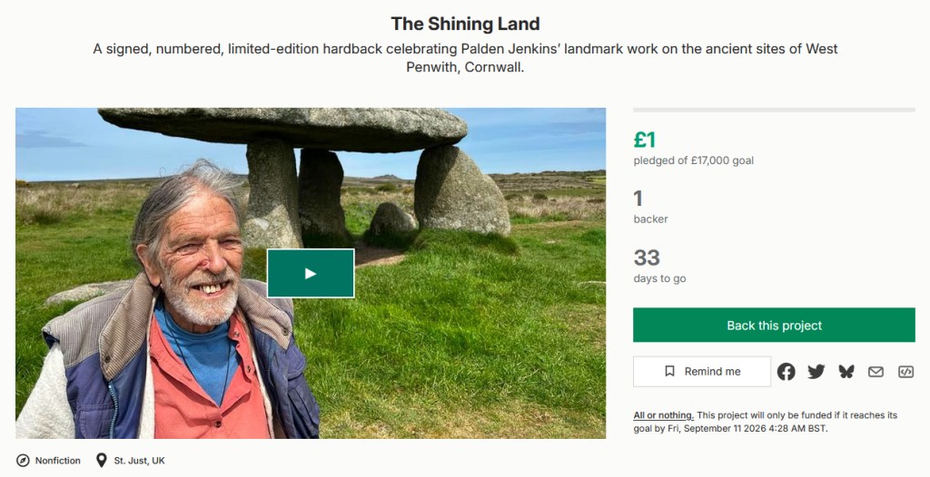
We’re starting a Kickstarter campaign to fund the production and printing of my book ‘Shining Land – the ancient sites of West Penwith and what they tell us about megalithic civilisation‘.
I’m really happy about this. Though I’m not bad at self-promotion, something in me dislikes it, and I’m doubly happy that some good friends have taken it on themselves to do this. To me, it suggests that the universe might be wanting this to happen.
You see, it’s not just because it’s my own book that’s getting published. Been there, done that. It’s the ideas inside. They are not generally accepted today – and this has been the story for me and for many, or all, other geomancers for too many decades.
In the book I propose an entirely different view about the meaning of ancient sites. I might not be correct in every detail, but the gist of what I am saying needs full and proper consideration. This will take time, and perhaps a new generation.
What am I saying? Well, previous postings give good tasters, and the book and an ample website are already available online, here…
It all starts from a simple observation. When you enter an ancient site you are entering a concentrated and consecrated energy-field. And you come out changed. This is not accidental.
I guess it’s a book of clues for a future time. A time when we address the matter of repairing the damaged energy-fields of our planet. It uses West Penwith (where I live) as an example of how this works.
I don’t have all the answers – this is the task of the coming decades, and I won’t be here to join in. But this book contains some fizzly keys and clues that might help. It moves things forward an inch. It’s all to do with energy-fields.
I’m glad it will come out in print. Thanks particularly to Rob, Rachel and Kai for what they are doing – and all other supporters too. It brings a big smile to my face!
Please permit me to invite you to contribute toward the print-publication of this book. It’s all here:
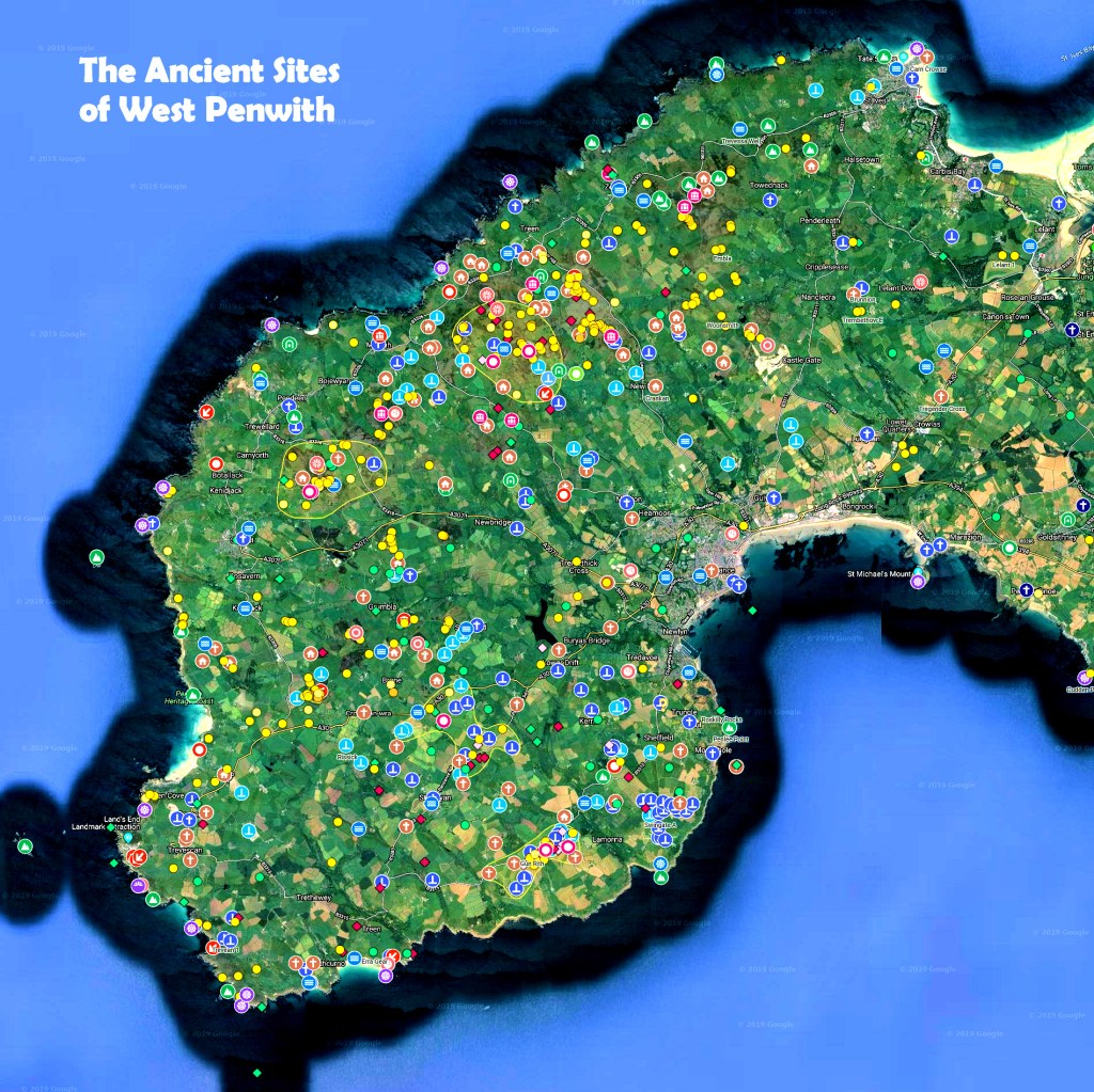
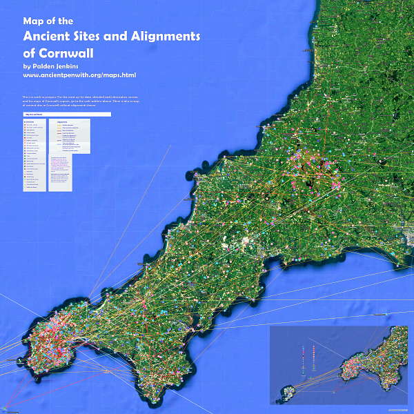
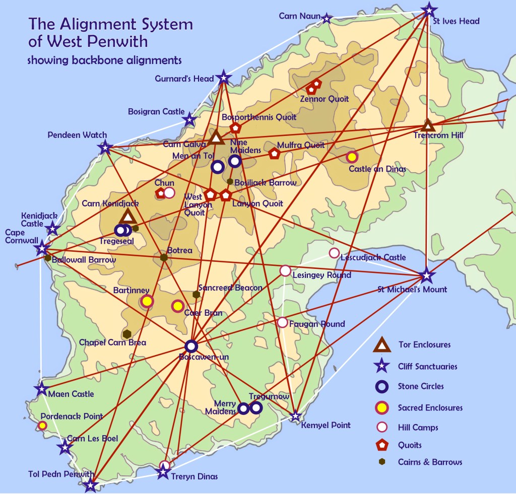
These maps go through an update about every six months – they were first researched and constructed between 2015 and 2022. They’ve just gone through another update.
You won’t notice much of a visible difference, because they’re also a database of information about each ancient site and alignment – and it is mostly these details that get updated. I have also done some weeding of a few alignments that are less plausible. Just click on any symbol or line, and info about it will pop up – including links to other useful sites, map references and more details.
The positioning of all ancient sites on the map is pretty exact, so you can use it to find them in the field. With a few carefully thought-through exceptions, all alignments are accurate to within just 3 metres or 10ft.
However, when you’re out visiting and ‘bothering’ sites, please consider this. Geomantic energies and mobile-phone signals are not compatible – it’s like playing heavy metal music loudly, next to a tinkling stream. So if you approach ancient sites with your phone switched on, you’re not only desensitising yourself, but also you are tampering with the energy-fields of the site you’re visiting. Just because what we call ‘earth energies’ cannot currently be detected by scientific instruments, it does not mean that this will always be the case. So pls to do not contribute to the contamination of the subtle energy-fields of ancient sites – whether or not you believe what I’m talking about. Thank you!
And do enjoy using the maps. They’re for you – if you’re mad on Cornwall.
and how the Tin Trade ended Cornish Megalithic Civilisation
This is for readers who are interested in ancient sites in Cornwall
I’m an historian who is deeply interested in prehistory, and I have an historian’s viewpoint, looking at longer-term processes at work over time. Over the last fifteen years I have done a lot of research in West Penwith, Cornwall, where I live, and here are a few new thoughts on that matter.
By examining its alignments system (see above) I was able to demonstrate that Penwith constituted a complete, integrated and focused magical landscape, an upgraded local ecosystem, and a cultured people who were at their peak in the Bronze Age.
This is about the transition from a matrifocal to a patriarchal culture, incrementally taking place during the Bronze Age.
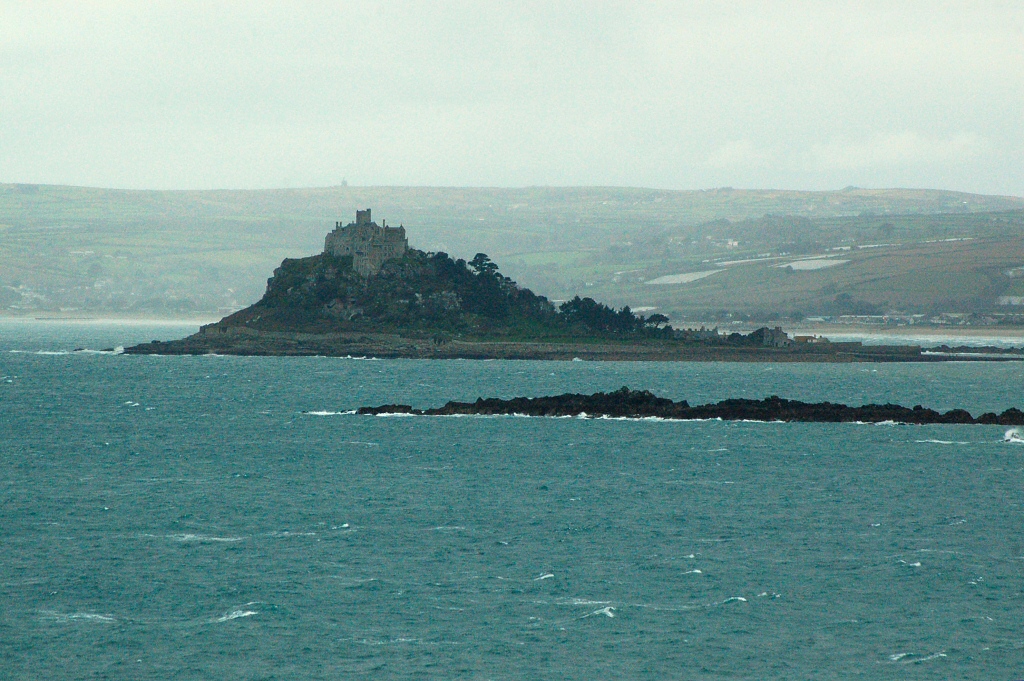
Now a peripheral place, in that time Penwith was a central place because long-distance travel took place by sea and river – the land was extensively wooded and tracks were muddy. Penwith lay on an ancient maritime trading and cultural corridor stretching from Iberia to Britain and Ireland, so boats came from Europe every summer, landing at St Michael’s Mount.
St Michael’s Mount
This pod is about the social and psycho-spiritual changes that went on through the 1,200 years of the megalithic part of the Bronze Age. It was a pretty sustainable culture, yet it was eventually overtaken by events.
An enchantment, uplifting the land and people, was shattered. The megalithic period came to an end around 1200 BCE. It was the end of a world – the Bronze Age Collapse, affecting Egypt, Greece, Mesopotamia and the whole of western Eurasia.
Recorded in the bluebell woods on our farm. For more about Penwith’s ancient sites, look here: ancientpenwith.org or here.
A talk given by Ba Miller and Palden Jenkins, sharing our thoughts, anecdotes and experiences in dowsing, geomancy, earth mysteries and consciousness.
It happened on Sunday afternoon, 7th December 2025, at The Hive in Penzance, Cornwall, and it’s for you.
It’s ‘limited edition’, with love from both of us. Gratitude to the organiser, Rachel Smart, presenter Lucy Cooper, songstress Lyndz Liquidlight and Hive hostess Maria Stay.
Ba Miller was involved with Hamish Miller and Paul Broadhurst in their research into the Michael Line and the Apollo Line, as detailed in their books ‘The Sun and the Serpent’ and ‘Dance of the Dragon’. Palden Jenkins is an astrologer and geomancer, author of ‘Shining Land’ and of www.ancientpenwith.org
It’s two hours. No charge, no strings. Hope you enjoy it.
This might interest those of you who are interested!
These are two chapters from my book about Penwith’s ancient sites, called Shining Land – except these two are about the whole of Cornwall.
From an alternative archaeologist’s viewpoint. With a few speculations thrown in for consideration. Food for thought. With love from the far end in (currently) wind-blown Penwith.
It’s a 20ish minute read (goes well with a mug of tea). I might do an audio version sometime – you never know.
Here’s my latest podcast. It’s all about why the ancients built their sacred sites. Well, my perception of it.
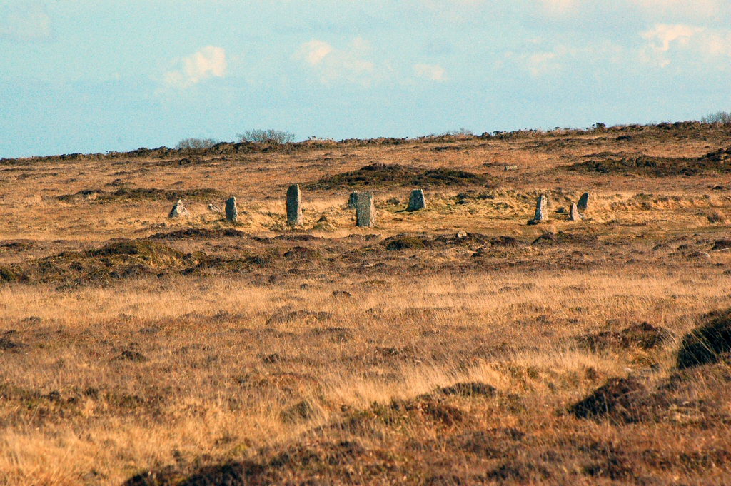
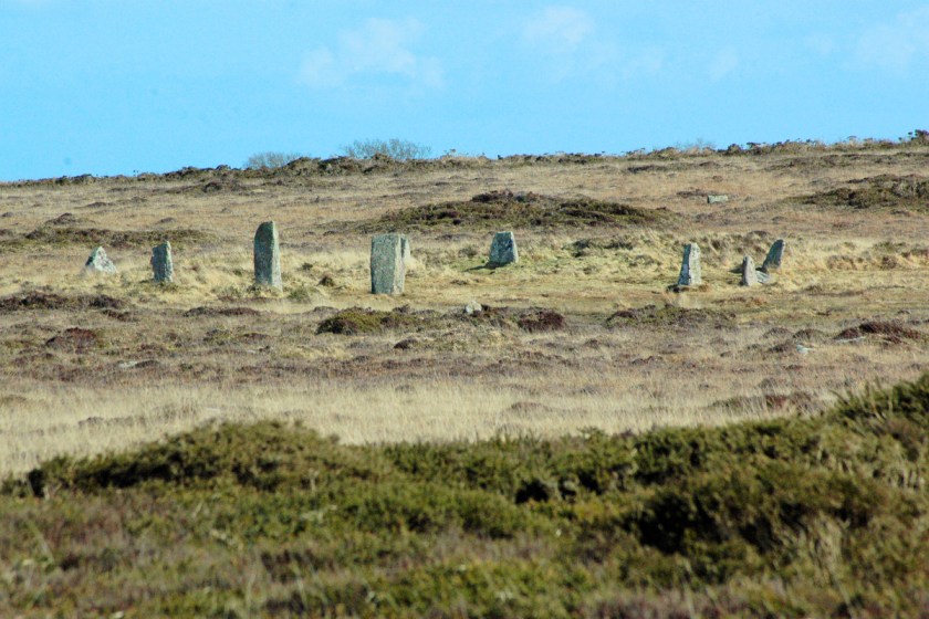
The Nine Maidens, West Penwith, Cornwall
There are thousands of megalithic sites around Britain and in other lands. The ancients didn’t build them for frivolous reasons – it had to bring them definite benefit to make it worth it, however they saw that. It was a big investment with longterm payoffs, going on for many centuries.
It’s all to do with cranked-up consciousness fields and the possibilities that become available when we do focused consciousness work inside them – at power points in space and during power points in time.
Reality’s rules can change and remarkable things can be achieved, even with practical, real-life outcomes. That’s what this podcast is all about. It’s about the way reality can be changed through inner work – or inner work combined with outer work.
Also, we become changed by doing so – this helps solve problems in remarkable ways, also reducing impediments we ourselves create.
The ancient sites of West Penwith and what they say about megalithic civilisation.
Audiobook version
I’m happy to say that the audiobook version of Shining Land is now done and ready. I’ve been working on it for the last month.
I tried to finish it before my birthday (on Friday 5th) but, well, life always has something to teach. I had one episode (of eleven) yet to record, but for two days there was a lot of noise from the rain, and from things going on around the farm, and I couldn’t do it! C’est la vie. I got it done eventually.
So now there is an audiobook version of Shining Land. Although it’s about the ancient sites in this area, West Penwith, at the far end of Cornwall, UK, I’ve adapted the audiobook to make it interesting to listeners far and wide who might never have been here.
The nub of this book and audiobook is megalithic civilisation. It was deeper and far more advanced than we are taught. Their high-tech achievements involved consciousness and energy, working on the nature of matter and the issues that life presents from the inside. It was a sustainable civilisation – in Britain, the megalithic periods of the Neolithic and Bronze Age lasted 500 and 1,200 years respectively.
And there’s a wee chance this might interest you! Audiobooks are great for listening to during long journeys, or while doing other things, or if you’re stuck in bed, or if you need a rest from radio stations.
Both the online book and the audiobook are available free, and voluntary donations are welcome.
The ancients worked with a kind of consciousness technology, and they designed their sacred sites for this purpose. They located them carefully, building them over underground water and energy-vortices, orienting them to the rising and setting points of the sun and moon, constructing them to reflect and embody the fundamental principles of the universe.
They did this to create spaces – crucibles – in which to go into altered states of consciousness. Here they could generate reality-fields that enabled them to reach into things and fix them from the inside.
They lived in a very different world to ours, with no need to build cities or empires since they were advanced in a completely different way. There’s something about this that we need to re-learn in our day, because it concerns our future. And that’s what this podcast is all about.
With love, Palden
It’s an extract from my book Shining Land, which is available online. A new update of the book is coming out soon.
Aluna, the Void, the Lap of the Mother, out of which everything emerges.
I posted this video a few years ago and it’s worth another spin. Because it speaks of matters I talk about too, though the Kogi Mamas state it far more clearly and unequivocally. It concerns the basis of the way nature works, and it starts in the realm of spirit.
It concerns connecting the power points with each other – the Kogi call them Esuamas – and helping the Earth hum and sing as an energy-being, a conscious being. If she is happy, all will be well, and nature can fix itself when damaged. Ecological reintegration. Rewilding.
This is what we, ‘the younger brother’, are failing to do. Then we wonder why we get flash floods, droughts and storms. We do this by blocking up the energy centres and obstructing their connections.
So, to help the world it is necessary to unblock them.
The Kogi, descendants of the pre-Columban Tairona civilisation, live in the Sierra Nevada of northern Colombia. In a recent article about Caer Brân, a Bronze Age gathering site here in West Penwith, Cornwall, I mentioned the sense of enhanced centrality you can feel at many ancient sites – the feeling of being at the centre of everything – and the Kogi feel that too. It’s a key element in the energy-geography of an area like theirs or like Penwith. They feel that the mountain area where they live lies at the Heart of the World. And it does.
They feel they cannot carry the world any more. In this film, Aluna, they speak of making payments, paying back to the Mother, caring for her and keeping her happy. They practice land management and agriculture that does just this.
In my rants and ramblings about the Neolithic and Bronze Age landscape of Penwith, I suggest that the 600-odd ancient sites in Penwith actually constituted one big ancient site, one big cliff sanctuary. Ancient Penwithians sought to make the land and the wider world hum and glow. Hence the ancient name for Penwith, ‘Belerion’ – the shining or scintillating land. They did it by connecting up the energy-centres to amp them up, to make them operate as one.
The Kogis’ ideas are not unique to them. We in Britain have known them too, a long time ago. We have forgotten. But if, when the time and your mood are right, you watch this film, you too might remember.
A Bronze Age gathering place in West Penwith, Cornwall Palden Jenkins, June 2025
Recently I was at Caer Brân (pronounced Ker Brayne) on a Belerion Project field trip. Nowadays partially disabled, I hadn’t been there for years, even though, when I look out of my window from my desk, it’s on the ridge over the valley, less than a mile away. So I gaze at it a lot.
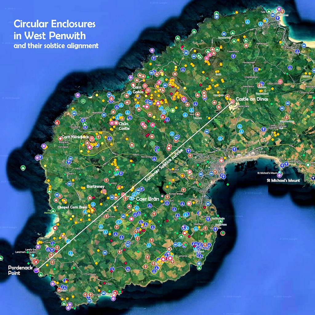
In former years I had come to the idea that, in the Mid-Bronze Age, Caer Brân served as a kind of parliament site for the whole of Penwith. This came to me after news came out some years ago about a circular enclosure, found using LIDAR scanning, on the cliffs at Pordenack Point, just south of Land’s End. This revealed something: Pordenack, Caer Brân and Castle an Dinas, three circular enclosures, were built in a straight line, oriented to the summer solstice sunrise.
This suddenly gave these three sites a lot more significance than had been seen previously.
However, if we take a line from the centre of the Pordenack clifftop enclosure to the centre of Castle an Dinas, it passes through Caer Brân though not accurately through its centre. It passes across the southeast side of Caer Brân, though within the enclosure. I’m not sure whether there is any meaning to that, but these details are worth observing.
At ancient sites, the main thing I do is a kind of psychic archaeology. That’s not as esoteric or complex as it sounds. All I do is sit there, relax, give it time, and I let feelings and ideas come up. It’s not a matter of trying, but of allowing. Often I use a pendulum, which helps engage both thinking and intuition. I do this in two ways, flipping between them: I use a pendulum while doing ‘intuitive free-thinking’ – it indicates when I’m ‘on track’ or ‘off track’ – and also I ask specific questions about details and dates, seeking a Yes/No answer. I note it all down or speak what’s coming up into a sound-recorder.
As an historian, I’m attentive to historic plausibility before jumping to conclusions arising from these ‘subjective’ researches. Mistakes can often be made in the interpretation of impressions and ideas, more than in their initial psycho-intuitive reception. It’s important to avoid allowing existing ideas, knowledge and preferences to shade and bias such findings, though it’s important afterwards to see how new insights fit with foregoing ones – if indeed they do.
If they don’t somehow fit, then the observation might either be incorrect or something is yet to be discovered that will make sense of it. In one case I had to wait twenty years. You get surprises. Findings might at first make no sense, or no concrete or logical evidence backs them up, but later on things can fall into place. So for much of the time they remain working hypotheses, not facts. One trick is to consider their plausibility and whether they shed light on anything else. Some archaeological findings suffer this problem, or their interpretation is conjectural – as is the case with a few seemingly authoritative statements on the signboard below Caer Brân (more below).
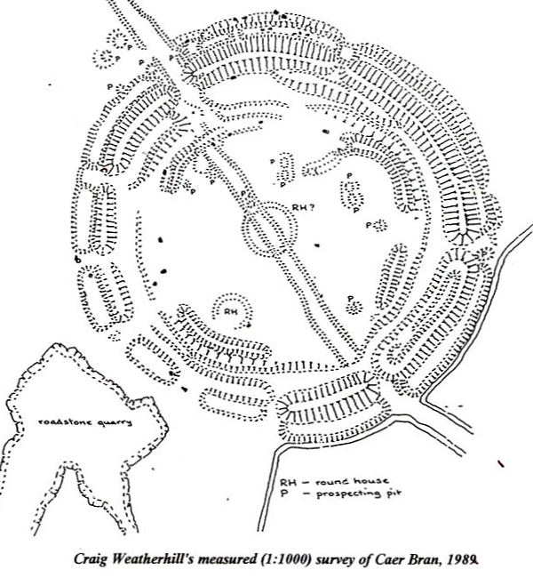
Craig Weatherhill’s survey of Caer Brân
Here are some findings from my recent visit to Caer Brân.
It seems to me that it is not the inherent earth energy of this place that matters, as is the case at a stone circle. There isn’t the same sense of energy here. It seems that the landscape positioning of Caer Brân matters more: there’s a strong visual connection with other key sites in Penwith and beyond, including Scilly, the Lizard and Carn Brea near Redruth. It has a wide, thirty-mile panorama.
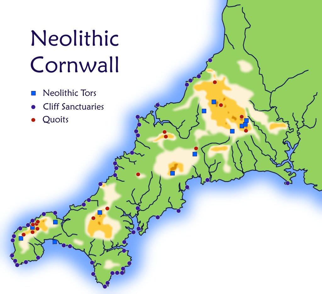
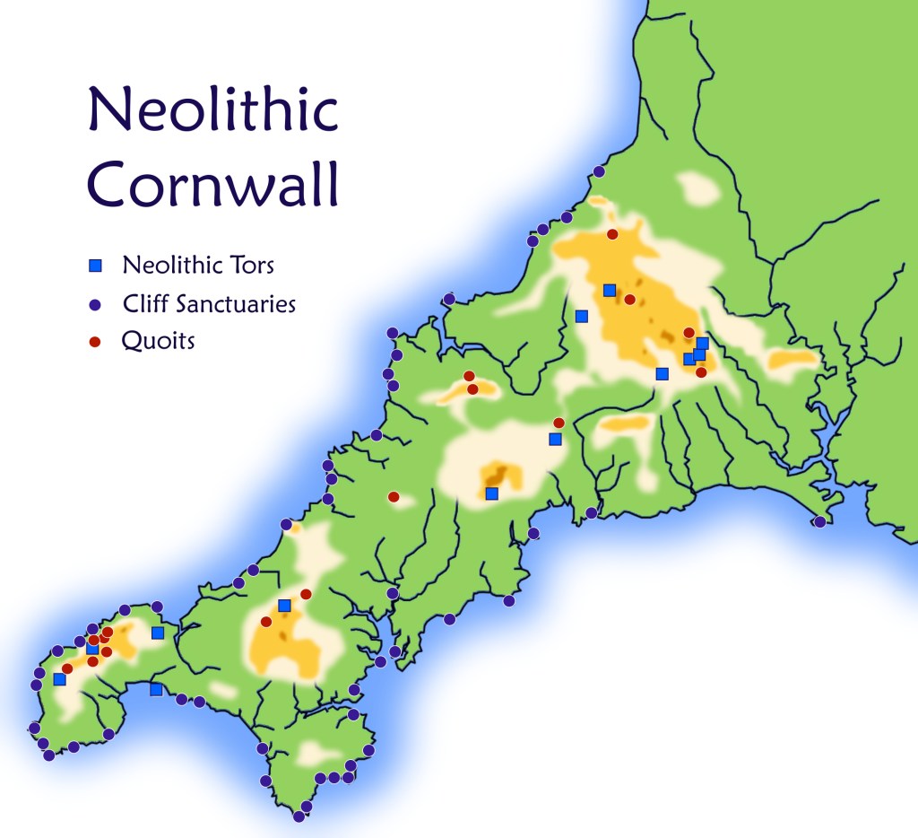
Very noticeable are the sightlines from Caer Brân to Neolithic sites which, at the time of Caer Brân’s building, would themselves have been regarded as ancient – about 1,800 years older than Caer Brân.
All of Penwith’s Neolithic sites are visible except Trencrom Hill. Carn Kenidjack and Carn Galva poke above the horizon as if placed there by an enormous geological chess-player’s hand; Carn Brea is distant yet prominent; St Michael’s Mount sits resplendently down in Mount’s Bay. The Isles of Scilly hover in the gap between Chapel Carn Brea and Bartinney Castle. So visual connectedness with other sites was clearly important. Caer Brân is not prominently visible from these sites – it’s a one-way visibility.
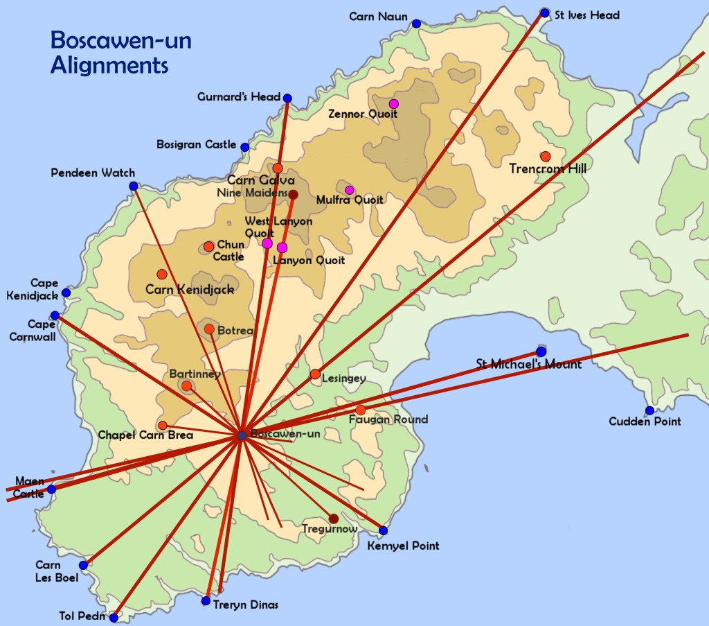
Apart from sightlines, it has several alignments (leylines) associating it with other ancient sites, yet these are largely rather unspectacular except for two. Alignments don’t seem to be a dominant factor here – sightlines are more important. (Click for an alignments map of Penwith.)
One alignment (83) goes from the summit cairn on nearby Chapel Carn Brea through Caer Brân’s SW edge to St Erth church (on an Iron Age round that might be older) and finally it heads for the Neolithic tor of Carn Brea.
The other (199) goes from Cape Cornwall to Caer Brân, then to the Blind Fiddler menhir and Kerris Round, then over Mount’s Bay to Predannack Head, a clifftop site on the Lizard that feels a bit like a geomantic control tower – it’s worth a visit. The first alignment links two Neolithic hills and the second links two major cliff sanctuaries.
Caer Brân doesn’t feel like a high-energy place, though it does have atmosphere. However, as a former gathering place, it feels to me as if it misses the human attention and ‘hwyl’ that it once witnessed and hosted. (Hwyl is Welsh for fun and stirring, special experiences).
Archaeologists commonly use the term ‘ceremonial’ for sites like this, but this is inaccurate. This was a gathering place, a people place. The enclosure uphill on Bartinney Castle was clearly ceremonial and magical, but I believe Caer Brân was mainly social in character and purpose.
These two adjacent sites, hardly a mile apart, formed a pair – Bartinney more spiritual and Caer Brân more worldly. During their moots, people assembled at Caer Brân probably trooped up to Bartinney for the spiritual high point of their gatherings, or to seal the deal. Tradition has it that inside the enclosure on Bartinney evil cannot touch you.
Sancreed Beacon, Caer Brân and Bartinney, arrayed along a ridge, were part of a local landscape temple also comprising Botrea Hill, Chapel Carn Brea and Boscawen-ûn stone circle. This ridge seems to act as a kind of fulcrum for the whole of Penwith, and Chapel Carn Brea, Botrea Hill and Boscawen-ûn anchor and stabilise it on either side.
This is all about a geomantic quality we could call ‘perceptual centrality’ – the feeling that you’re standing at the centre of everything. This is common at many ancient sites: a subtle sense of emphasised hereness and nowness that is one of their key psycho-spiritual effects. It seems odd that Boscawen-ûn acts as a peripheral anchor to this string of three hills. Yet this is how it seems at Caer Brân, standing at the centre of its own psycho-geographic gravity-field. Yet at Boscawen-ûn, sitting at the centre of its own perceptual gravity field, it seems as if Caer Brân and Chapel Carn Brea are peripheral appendages to it.
Each major site in Penwith is a gravity-centre of psycho-geographic experience. In one sense this is a perceptual matter, while in another it’s a very real, a repeatable experience shared by many people. In a pre-literate society with no maps or aerial photos, people were psychologically part of their world and it was part of them. They perceived their world differently to us.
This was particularly so in the Neolithic. As the Bronze Age progressed, man-made landscape expanded in extent and people started developing more of a sense of mastery of nature rather than of being guests in it. Even so, their ancient sites were stretched over and fitted to nature and the landscape without imposing on them. Bronzies’ nature-interventions were largely sympathetic. Rampant resource exploitation came later in history.
On the signboard downhill from Caer Brân I think they got a few details wrong. They associate Caer Brân with Carn Euny, a nearby ancient settlement, suggesting that the villagers had built and used it. That’s logical, though I think it is incorrect.
The impression I get is that Caer Brân was a Penwith-wide social-infrastructure project. People were called up from all over Penwith to build it. It was to be a neutral space, owned or hosted by no individual clan. It was to act as a meeting place for all of the Penwithian clans, or their representatives. It’s possible there were around ten clans.
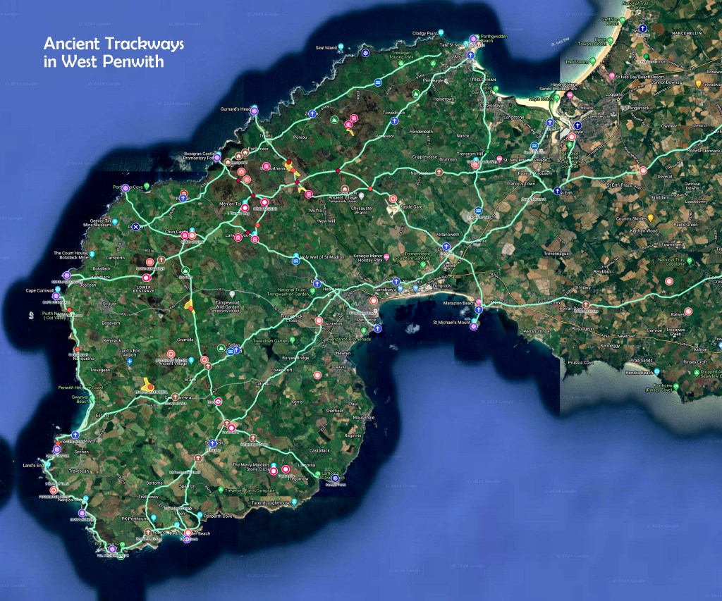
Its geographic centrality in Penwith and its location at the crossroads of two major ancient trackways are clues suggesting this (see trackway map below), together with the solstice alignment of the three circular sites. So while Carn Euny looks like a logical ‘owner’ of Caer Brân, I don’t think this was so. Neither was Castle an Dinas, Penwith’s other big gathering site, controlled by one clan. It is likely it was built around the same time as Caer Brân, and that they were built with different purposes in mind.
Using a pendulum, I asked how long it took to build Caer Brân: I got ‘two summers’. That was surprising: I expected longer (such as five years). This would have involved quite a mobilisation of available hands and backup support, including supplying tools and food and maintaining life’s normal demands back home. They wanted to get the job done quickly.
Perhaps there was an urgent need. Perhaps they had reached a kind of political juncture in Penwith, where a pressing need came up to reorganise things, reflecting emergent needs and realities. Or perhaps there was a generational shift in a time of social change and population growth, necessitating the building of new gathering places.
The signboard got one thing right: the ‘ring cairns’ inside Caer Brân are older than the enclosure. I date-dowsed them to the 2200s BCE, while the enclosure came 400ish years later in the 1830s. Except that the ‘ring cairns’ were roundhuts. The one in the centre of Caer Brân gave me the sense of a Hopi Kiva, a place for focused magical-spiritual work – I got the image of a crucible. It was placed there not because of a major energy-vortex at that place, but because of its visual, almost geometric connections with other places in the wider landscape.
I found that three main gatherings were held each year: on the fullmoons around Imbolc and Lughnasa, and another in early December. I asked why this third one was not at winter solstice and got a straight reply, ‘Everyone wanted to be at home then’. Well, indeed. And since fullmoons light up the night, often marking shifts in the season or in weather patterns, the Bronzies were probably not as concerned with exact cross-quarter days as with the fullmoons near to them. The moon provided no-cost solar-powered lighting. And a taste of magic.
The climate was a bit warmer then, less windy, stormy and Atlantic-dominated than it is now. This changed around the 1200s at the end of the Megalithic period – the jetstream moved south, bringing more wind, rain and changeable weather. It made sense in the Neolithic and Bronze Ages to be on panoramic hilltops like Caer Brân. In the Late Bronze Age after 1200ish, people moved downhill, abandoning or sidelining many of the megalithic sites.
Date dowsing suggests that Caer Brân was built in the 1830s BCE and was in use until the 1330s. This is longer than archaeologists reckon – it’s that signboard again. They give Caer Brân a short active life, on the basis that a gap in the ‘ramparts’ in the southwest of the enclosure represents an unfinished segment, and that, ergo, the enclosure was abandoned at the end of its construction.
This seemingly logical conclusion seems to me to be flimsy. Abandoning a project that is 95% complete is a bit strange. The abandonment idea was probably adopted in the days when archaeologists saw Caer Brân as a ‘hillfort’ built for defensive purposes. But, nationwide, the majority of hillforts were not built for this – especially in Penwith, where there are no signs of prehistoric conflict. There is no evidence of outright abandonment of Caer Brân either – it’s a best guess. No, I think that gap was deliberate. However, I cannot figure out why it was built so, and this question needs more work.
While we’re here, it’s worth observing that the second roundhut toward the southwest edge of the enclosure, marked on Craig Weatherhill’s survey, is also at the crossing point of four local alignments and close to the Pordenack to Castle an Dinas solar alignment, which crosses Caer Brân off-centre. From this we can surmise that this was probably no ordinary residential roundhut, instead having some sort of magical meaning. If alignments pass through a roundhut, in my experience it is likely that it was not residential in purpose.
In a moment of vision, I saw twentyish elders sitting in an arc, presiding over long discussions. I feel this was the political meeting place in Penwith. What came to me was this: it took until 1800 BCE to build Caer Brân because only by that date had the newly-colonised south of Penwith really been fully established. The south was colonised in the Bronze Age as population grew and bronze tools for clearing trees and land came into common use, probably around 2200-2000 BCE. A gradual southward population move would follow, shifting the balance of population. Until then the traditional power centre was around Chûn, Carn Galva and Zennor Hill in the north.
So by 1800 the centre of gravity had shifted south. The Boscawen-ûn and Merry Maidens stone circle complexes had been built, together with strings of menhirs, and the area had been opened up. By then, about half of Penwith was forested. Areas were cleared with landscape perspectives and sightlines in mind – these avenues highlighting features in the wider landscape were a key part of an ancient site and the geomantic thinking behind it. The Bronzies were not the nature-rapists that we moderns have become, and felling trees manually and harvesting their timbers was a big, slow job. They did it thoughtfully, needing to keep the gods and spirits happy too. So they felled trees selectively, creating a parkland landscape with open, grazed areas and patches of wildwood.
This is probably why it took until 1800 BCE for Caer Brân to be built. Only by then did people realise there was a need for it. Or perhaps only then did the perceived need override the inertia of carrying on as they’d always done. It’s the connectedness and centrality of this place that is a large part of its reason for being. But in the Neolithic and Early Bronze Age it was not central to people’s lives – it became so in the Mid-Bronze Age, by 1800 BCE.
Castle an Dinas, Penwith’s other big gathering site, is very visible from Caer Brân. The summer solstice sun rises above it. Clearly they were connected, though they probably served contrasting or complementary purposes. There is evidence of trading at Castle an Dinas, and it is likely that it hosted gatherings at other times of year such as Beltane and Samhain. Two astronomical alignments from its centre suggest this: one to Trencrom Hill and the other to Conquer Cairn. Gatherings were possibly held at summer solstice too – suggested by the solstice alignment from Caer Brân. I get the feeling there was more socialising and celebration at Castle an Dinas than at Caer Brân. Perhaps Castle an Dinas needs further investigation.
Caer Brân stood near the crossroads of two major trackways. So I think this is an ideal place for a kind of parliament, for decision-making moots and occasions for the settling of inter-clan issues. Decisions would not only have involved discussion but also deep-level processes, consultation with the gods and the ancestors – perhaps up on Bartinney. There would be meetings with relatives and old friends from around the peninsula, social rites, discussions and late-night ceilidhs around campfires – a festival for a few hundred people, for 3-4 days.
Downhill there’s a smaller, non-circular enclosure. I asked what this was for. A simple answer came: animals. I saw two possibilities. In between gatherings they probably kept animals in Caer Brân to graze and mow it, moving them down to the lower enclosure for the duration of a festival. Alternatively, when horses came into use around the 1500s, it was where they kept the horses. In other words, methinks the lower enclosure was built to serve practical purposes.
The Belerion Project is a citizen research project and stream of consciousness in West Penwith. We seek to encourage psycho-intuitive investigation of the ancient sites of West Penwith, and hopefully to make such work more systematic. It’s in its early stages at present. At minimum participants will acquire a habit of building up their skills in such intuitive work, and keeping and collating notes. Possibly, after a few years, a comprehensive body of work might emerge too – an energy survey and magical assessment of Penwith’s major ancient sites.
If it interests you to join the project and you live in or near Penwith, check out the Belerion link below and come on a field trip. This project can run alongside archaeological research and, I believe, contribute many clues. Of which I hope this study has a few!
So this has been a study of a site that is, I believe, underestimated in its significance and importance. It is very central in Penwith, and its main remains are simply a circular embankment in a prominent hilltop place. But I suggest that it was the place where people periodically assembled to discuss and sort out tribal matters concerning the whole of Penwith. And if not this, then what?













You must be logged in to post a comment.